
Lorance Mathew
Industries Extension Officer,
Dept. of Industries and Commerce, Govt. of Kerala.
[email protected]
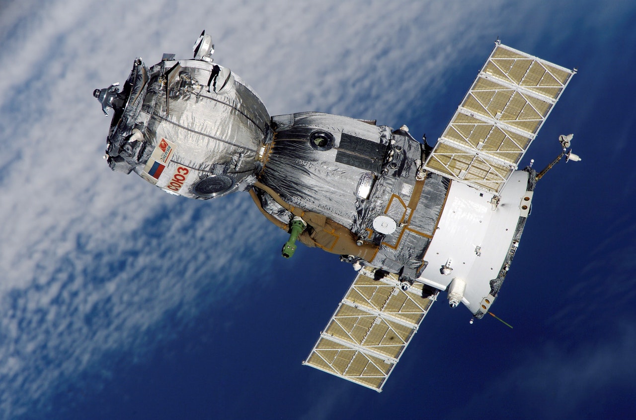
ഭാവിയുടെ തൊഴില് മേഖലയായി കരുതാവുന്നതാണ് റിമോട്ട് സെൻസിങ്ങും അതുമായി ബന്ധപ്പെട്ട മറ്റു ശാഖകളും. ഒരു വസ്തുവിനെ ദൂരെ നിന്നു പരിശോധിച്ച് അതിനെക്കുറിച്ചുള്ള വിവരങ്ങള് ശേഖരിക്കുന്ന ശാസ്ത്ര ശാഖയ്ക്കാണ് റിമോട്ട് സെൻസിങ്ങ് എന്ന് പറയുന്നത്. വസ്തുവില് നിന്നും കുറേ ദൂരെ നിൽക്കുന്ന ഒരു സെൻസര് ഉപയോഗിച്ചാണ് ആ വസ്തുവിനെക്കുറിച്ചുള്ള വിവരങ്ങള് തിരഞ്ഞ് പിടിക്കുന്നത്. ഉപഗ്രഹത്തിലോ വിമാനത്തിലോ ഘടിപ്പിച്ച ഉപകരണങ്ങള് ഉപയോഗിച്ച് ഭൂമിയുടെ അന്തരീക്ഷത്തില് നിന്നും പുറം തള്ളപ്പെടുന്ന ഇലക്ട്രോ മാഗ്നറ്റിക് റേഡിയേഷന് പരിശോധിക്കുന്ന രീതിയാണ് റിമോട്ട് സെൻസിങ്ങ്. ഭൌമോപരിതലത്തെക്കുറിച്ചറിയാനുള്ള പല മാർഗ്ഗങ്ങളിലൊന്നാണിത്. ജല വിഭവ ശേഷി മുതല് പരിസ്ഥിതി മലിനീകരണത്തിന്റെ അളവു വരെ റിമോട്ട് ഡെൻസിങ്ങിലൂടെ ലഭിക്കുന്നു. കാട്ടു തീ, എണ്ണപ്പാട തുടങ്ങിയ ദുരിതങ്ങള് ഉണ്ടാവുന്ന സമയത്ത് കൃത്യമായി ഇടപെടാന് ഇത് സഹായിക്കുന്നു. എൻവയൺമെന്റൽ മോണിറ്ററിങ്ങ്, മാപ്പിങ്ങ്, കാലാവസ്ഥാ പ്രവചനം, ലോഹപര്യവേക്ഷണം തുടങ്ങിയ മേഖലകളിലെല്ലാം റിമോട്ട് സെൻസിങ്ങ് ഇന്ന് ഉപയോഗപ്പെടുത്തി വരുന്നു.
ഈ വിഷയം പഠിക്കുവാന് ഇന്ത്യയുടെ അഭിമാന സ്തംഭമായ ഐ എസ് ആർ ഒ ഒരുക്കിയിരിക്കുന്ന സ്ഥാപനമാണ് Indian Institute of Remote Sensing (IIRS). ഒരു ISO 9001:2008 സ്ഥാപനമായ ഇതിന്റെ ആസ്ഥാനം ഡെറാഡൂണിലാണ്. ജിയോ ഇൻഫോർമാറ്റിക്സുമായി ബന്ധപ്പെട്ട വിഷയങ്ങളില് ഗവേഷണത്തിന് ഇത്രയും ഉത്തമമായ സ്ഥാപനം മറ്റൊന്നില്ല തന്നെ. ഗവേഷണ തൽപ്പരരായ ചെറുപ്പക്കാർക്ക് ഏറ്റവും അനുയോജ്യമാണ് ഇവിടം. ഈ സ്ഥാപനത്തിലെ ജോലി വെറും ഒരു ജോലി എന്നതിനപ്പുറം രാജ്യത്തിന്റെ വികസനത്തില് പങ്കാളികളാകുവാനുള്ള അവസരവുമാണ് നമുക്ക് തരുന്നത്. ഈ മേഖലയില് നിരവധി കോഴ്സുകളും ട്രെയിനിങ്ങ് പ്രോഗ്രാമുകളുമിവിടെയുണ്ട്.
പ്രോഗ്രാമുകൾ
MSc & M.Tech Courses
2 വർഷത്തെ കോഴ്സാണിത്. പ്ലസ്ടു തലത്തില് Mathematics ഉം പിന്നെ Physics/Chemistry/Statistics/Biology/Computer Science എന്നിവയിലേതെങ്കിലും പഠിച്ചിരിക്കണം. 45 വയസ്സാണ് പ്രായ പരിധി. പ്രവേശന പരീക്ഷയുണ്ടാവും. Ahmedabad, Bangalore, Dehradun, Delhi, Hyderabad, Kolkata, Nagpur, Lucknow, Shillong and Thiruvananthapuram എന്നിവയാണ് സെന്ററുകൾ. ഓൺലൈനായി അപേക്ഷിക്കാം.
1. M.Sc. in Geo-information Science & Earth Observation with specialization in Geoinformatics
M.Sc./ M.Sc.(Tech.)/M.Tech. in Physics/Appl. Physics/ Electronics/ Maths/ Applied Maths/ Stattistics/ IT/ Computer Science/Geol./Geophy./Geo-Engg./Agriculture/ Forestry/ Horticulture/Environmental Science or equivalent (OR) B.E./ B.Tech. in Civil/ ECE/ Electron./ Comp. Sci./ IT/ Electrical/ Geoinformatics/ Agricultural Engg./ Geoscence./ Petroleum Engg./ Mining Engg./ Agricultural informatice/ Forest Inform. or equivalent (OR) B.Arch./ B.Plan./ M.Arch./ M.Plan. (OR) Master’s in Geography (OR) Govt officials having B.Sc degree എന്നിവയിലേതെങ്കിലും യോഗ്യത വേണം. 55 ശതമാനം മാർക്കുണ്ടാവണം. പ്ലസ്ടു തലത്തില് Mathematics ഉം പിന്നെ Physics/Chemistry/Statistics/Biology/Comp. Science എന്നിവയിലേതെങ്കിലും പഠിച്ചിരിക്കണം. 45 വയസ്സാണ് പ്രായ പരിധി. പ്രവേശന പരീക്ഷയുണ്ടാവും. Ahmedabad, Bangalore, Dehradun, Delhi, Hyderabad, Kolkata, Nagpur, Lucknow, Shillong and Thiruvananthapuram എന്നിവയാണ് സെന്ററുകൾ. ഓൺലൈനായി അപേക്ഷിക്കാം. 10 സീറ്റാണുള്ളത്.
2. M.TECH. in Remote Sensing & GIS (Specialization Geoinformatics)
55 ശതമാനം മാർക്കോടെ M.Sc./ M.Tech. in Physics/Appl. Physics/Electronics/ Maths/ Appl. Maths/ Stat./ IT/ Comp. Sci./ Comp. Applications/ Geoinform. or equivalent/ Geo-Engg. (OR) B.E./ B.Tech. in Civil/ ECE/ Electron./ Electrical/ Comp. Sci./ CSE/ IT/ Geoinform. or equivalent/ Agricultural informatics./ Forest Informatics (OR) Master’s in Geography എന്നിവയിലേതെങ്കിലും യോഗ്യത വേണം. പ്ലസ്ടു തലത്തില് Mathematics ഉം പിന്നെ Physics/Chemistry/Statistics/Biology/Comp. Science എന്നിവയിലേതെങ്കിലും പഠിച്ചിരിക്കണം. 45 വയസ്സാണ് പ്രായ പരിധി. പ്രവേശന പരീക്ഷയുണ്ടാവും. Ahmedabad, Bangalore, Dehradun, Delhi, Hyderabad, Kolkata, Nagpur, Lucknow, Shillong and Thiruvananthapuram എന്നിവയാണ് സെന്ററുകൾ. ഓൺലൈനായി അപേക്ഷിക്കാം. 40 സീറ്റാണുള്ളത്.
3. M.TECH. in Remote Sensing & GIS (Specialization Water Resources)
55 ശതമാനം മാർക്കോടെ M.Sc./ M.Sc. (Tech)/ M.Tech. in Agricultural Engg./ Hydrology/ Water Resource Engg./ Water Resource Management/ Geololgy/ Environmental Science or equivalent (OR) B.E./ B.Tech. in Civil Engg./ Agricultural Engg./ Water Res. Engg. or equivalent എന്നിവയിലേതെങ്കിലും യോഗ്യത വേണം. പ്ലസ്ടു തലത്തില് Mathematics ഉം പിന്നെ Physics/Chemistry/Statistics/Biology/Computer Science എന്നിവയിലേതെങ്കിലും പഠിച്ചിരിക്കണം. 45 വയസ്സാണ് പ്രായ പരിധി. പ്രവേശന പരീക്ഷയുണ്ടാവും. Ahmedabad, Bangalore, Dehradun, Delhi, Hyderabad, Kolkata, Nagpur, Lucknow, Shillong and Thiruvananthapuram എന്നിവയാണ് സെന്ററുകൾ. ഓൺലൈനായി അപേക്ഷിക്കാം. 40 സീറ്റാണുള്ളത്.
4. M.TECH. in Remote Sensing & GIS (Specialization Satellite Image Analysis & Photogrammetry)
55 ശതമാനം മാർക്കോടെ M.Sc./M.Tech. (Phy./Appl. Phy./Maths/Stat./Appl. Maths/Comp Sci./Geoinform./ Civil IT/ Geography or equivalent) (OR) B.E./B.Tech.(Civil/Electronics/Electrical/Electrical & Electron./ECE/Comp. Sci./IT/Geoinform. or equivalent) എന്നിവയിലേതെങ്കിലും യോഗ്യത വേണം. പ്ലസ്ടു തലത്തില് Mathematics ഉം പിന്നെ Physics/Chemistry/Statistics/Biology/Comp. Science എന്നിവയിലേതെങ്കിലും പഠിച്ചിരിക്കണം. 45 വയസ്സാണ് പ്രായ പരിധി. പ്രവേശന പരീക്ഷയുണ്ടാവും. Ahmedabad, Bangalore, Dehradun, Delhi, Hyderabad, Kolkata, Nagpur, Lucknow, Shillong and Thiruvananthapuram എന്നിവയാണ് സെന്ററുകൾ. ഓൺലൈനായി അപേക്ഷിക്കാം. 40 സീറ്റാണുള്ളത്.
5. M.TECH. in Remote Sensing & GIS (Marine & Atmospheric Sciences)
55 ശതമാനം മാർക്കോടെ M.Sc. (Marine Sci./Earth Science/Physics/Oceanography./Meteorology/Atmospheric Science/Environmental Science/Maths) (OR) Masters in Geography എന്നിവയിലേതെങ്കിലും യോഗ്യത വേണം. പ്ലസ്ടു തലത്തില് Mathematics ഉം പിന്നെ Physics/Chemistry/Statistics/Biology/Comp. Science എന്നിവയിലേതെങ്കിലും പഠിച്ചിരിക്കണം. 45 വയസ്സാണ് പ്രായ പരിധി. പ്രവേശന പരീക്ഷയുണ്ടാവും. Ahmedabad, Bangalore, Dehradun, Delhi, Hyderabad, Kolkata, Nagpur, Lucknow, Shillong and Thiruvananthapuram എന്നിവയാണ് സെന്ററുകൾ. ഓൺലൈനായി അപേക്ഷിക്കാം. 40 സീറ്റാണുള്ളത്.
6. M.TECH. in Remote Sensing & GIS (Urban & Regional Studies)
55 ശതമാനം മാർക്കോടെ Master’s (Planning/Architecture/Civil/Computer Science/Geoinformatics/Environmental Sc.ience or equivalent) (OR) B.Plan./ B.Arch. or equivalent (OR) B.E./ B.Tech.(Civil/Comp. Sci/ Geoinformatics or equivalent (OR) Master’s in Geography.എന്നിവയിലേതെങ്കിലും യോഗ്യത വേണം. പ്ലസ്ടു തലത്തില് Mathematics ഉം പിന്നെ Physics/Chemistry/Statistics/Biology/Comp. Science എന്നിവയിലേതെങ്കിലും പഠിച്ചിരിക്കണം. 45 വയസ്സാണ് പ്രായ പരിധി. പ്രവേശന പരീക്ഷയുണ്ടാവും. Ahmedabad, Bangalore, Dehradun, Delhi, Hyderabad, Kolkata, Nagpur, Lucknow, Shillong and Thiruvananthapuram എന്നിവയാണ് സെന്ററുകൾ. ഓൺലൈനായി അപേക്ഷിക്കാം. 40 സീറ്റാണുള്ളത്.
7. M.TECH. in Remote Sensing & GIS (Natural Hazards & Disaster Risk Management)
55 ശതമാനം മാർക്കോടെ M.Sc (Disaster Management/Natural Resource M/ Env. Mgmt./Meteorology/ Phy./ Maths./ Botany/ Zoology./Geog./ Earth Sci./ Env Sci./ Marine sci./ Atm. Sci./ Agri./ Forestry (OR) B.Arch./ B.Plan./M.Plan. (OR) B.E./ B.Tech. (Civil Engg./Env. Engg./Geosci./Geoexplor./Geo-Engg./Earthquake Engg./ IT/ Comp. Sci.) (OR) Master’s in Geography.എന്നിവയിലേതെങ്കിലും യോഗ്യത വേണം. പ്ലസ്ടു തലത്തില് Mathematics ഉം പിന്നെ Physics/Chemistry/Statistics/Biology/Comp. Science എന്നിവയിലേതെങ്കിലും പഠിച്ചിരിക്കണം. 45 വയസ്സാണ് പ്രായ പരിധി. പ്രവേശന പരീക്ഷയുണ്ടാവും. Ahmedabad, Bangalore, Dehradun, Delhi, Hyderabad, Kolkata, Nagpur, Lucknow, Shillong and Thiruvananthapuram എന്നിവയാണ് സെന്ററുകൾ. ഓൺലൈനായി അപേക്ഷിക്കാം. 40 സീറ്റാണുള്ളത്.
8. M.TECH. in Remote Sensing & GIS (Geosciences)
55 ശതമാനം മാർക്കോടെ M.Sc./ M.Sc.(Tech.)/ M.Tech. (Geol./Appl.ied Geology/Geophysics/Earth Science/Geoexplor./Petroleum Engg./Geo Technical Engg./ Mining Engg./Geography) (OR) B.Tech./B.E. (Civil Engg./Geoscience./Petroleum Engg./Mining Engg./Mineral Processing).എന്നിവയിലേതെങ്കിലും യോഗ്യത വേണം. പ്ലസ്ടു തലത്തില് Mathematics ഉം പിന്നെ Physics/Chemistry/Statistics/Biology/Comp. Science എന്നിവയിലേതെങ്കിലും പഠിച്ചിരിക്കണം. 45 വയസ്സാണ് പ്രായ പരിധി. പ്രവേശന പരീക്ഷയുണ്ടാവും. Ahmedabad, Bangalore, Dehradun, Delhi, Hyderabad, Kolkata, Nagpur, Lucknow, Shillong and Thiruvananthapuram എന്നിവയാണ് സെന്ററുകൾ. ഓൺലൈനായി അപേക്ഷിക്കാം. 40 സീറ്റാണുള്ളത്.
9. M.TECH. in Remote Sensing & GIS (Forest Resources & Ecosystem Analysis)
55 ശതമാനം M.Sc. (Forestry/Ecology/Botany/Wildlife Sci./Bioscience/Zoology/Environmental Science/Environmental Management/ Natural Resources Management/ Life Sci./ Plant Science.) (OR) B.E./B.Tech. (Biotech./Forest. Biotech/Bioinformatics/ Environmental Engg) (OR) Masters in Geography എന്നിവയിലേതെങ്കിലും യോഗ്യത വേണം. പ്ലസ്ടു തലത്തില് Mathematics ഉം പിന്നെ Physics/Chemistry/Statistics/Biology/Comp. Science എന്നിവയിലേതെങ്കിലും പഠിച്ചിരിക്കണം. 45 വയസ്സാണ് പ്രായ പരിധി. പ്രവേശന പരീക്ഷയുണ്ടാവും. Ahmedabad, Bangalore, Dehradun, Delhi, Hyderabad, Kolkata, Nagpur, Lucknow, Shillong and Thiruvananthapuram എന്നിവയാണ് സെന്ററുകൾ. ഓൺലൈനായി അപേക്ഷിക്കാം. 40 സീറ്റാണുള്ളത്.
10. M.TECH. in Remote Sensing & GIS (Agriculture & Soils)
55 ശതമാനം M.Sc in Agriculture/ Agricultural Physics/ Soil Science/ Agrometeriology/ Entomology/ Pathology/ Agronomy/ Plant Physiol./ Horticulture/ Agric. Botany/ Soil Conservation & Water Management/ Climate change Adaptation/ Environmental Science or equivalent (OR) B.E./ B.Tech. in Agricultural Engg./ Agricultural Informatics/ Agricultural & Food Engg. or equivalent (OR) Master’s in Geography എന്നിവയിലേതെങ്കിലും യോഗ്യത വേണം. 40 സീറ്റാണുള്ളത്.
Post Graduate Diploma Courses
ഒരു വർഷമാണ് കാലാവധി. പ്ലസ്ടു തലത്തില് Physics/Chemistry/Statistics/Biology/Computer Science എന്നിവയിലേതെങ്കിലും 2 വിഷയം പഠിച്ചിരിക്കണം. 45 വയസ്സാണ് പ്രായ പരിധി. പ്രവേശന പരീക്ഷയുണ്ടാവും. Ahmedabad, Bangalore, Dehradun, Delhi, Hyderabad, Kolkata, Nagpur, Lucknow, Shillong and Thiruvananthapuram എന്നിവയാണ് സെന്ററുകൾ. ഓൺലൈനായി അപേക്ഷിക്കാം. 48 സീറ്റാണുള്ളത്.
1. Post Graduate Diploma (PGD) in Remote Sensing & GIS (Agriculture & Soils)
55 ശതമാന മാർക്കോടെ M.Sc in Agriculture/Agricultural Physics/ Soil Science/ Agrometeriology/ Entomology/ Pathology/ Agronomy/ Plant Physiology/ Horticulture/ Agricultural Botany/ Soil Conservation & Water Management/ Climate change Adaptation/ Environmental Science or equivalent (OR) B.E./ B.tech. in Agricultural Engg./ Agri. Informatics/ Agricultural & Food Engg. or equivalent (OR) B.Sc. (4 years degree) in Agriculture/ Horticulture/ Sericulture (OR) Master’s in Geography എന്നിവയിലേതെങ്കിലും യോഗ്യത വേണം.
2. Post Graduate Diploma (PGD) in Remote Sensing & GIS (Forest Resources & Ecosystem Analysis)
55 ശതമാന മാർക്കോടെ M.Sc. (Forestry/Ecology/Botany/Wildlife Science/Bioscience/Zoology/Env.ironmental Science/Environmental Management Natural Resources Management/ Life Sci./ Plant Sci.) (OR) 4 years B.Sc. (Forestry/ Biotech./Forest-Biotech./Bioinformatics) (OR) B.E./B.Tech. (Biotech./Forest. Biotech/Bioinformatics/ Environmental Engg) (OR) Masters in Geography എന്നിവയിലേതെങ്കിലും യോഗ്യത വേണം.
3. Post Graduate Diploma (PGD) in Remote Sensing & GIS (Geosciences)
55 ശതമാന മാർക്കോടെ M.Sc./ M.Sc.(Tech.)/ M.Tech. (Geol./Appl. Geology/Geophy./Earth Science/Geoexplor./Petrol. Engg./Geo-Engg./ Mining Engg./Geography) (OR) B.Tech./B.E. (Civil Engg./Geosci./Petrol. Engg./Mining Engg./Mineral Processing) എന്നിവയിലേതെങ്കിലും യോഗ്യത വേണം.
4. Post Graduate Diploma (PGD) in Remote Sensing & GIS (Urban & Regional Studies)
55 ശതമാന മാർക്കോടെ Master’s (Plan./Arch./Civil/Comp. Sci. or eq./Geoinformatics or equivalent/Env. Sc./ Geography or Equivalent) (OR) B.Plan./ B.Arch. Or equivalent (OR) B.E./ B.Tech.(Civil/Comp. Sci/ Geoinformatics. or equivalent) എന്നിവയിലേതെങ്കിലും യോഗ്യത വേണം. പ്ലസ്ടു തലത്തില് Physics/Chemistry/Statistics/Biology/Computer Science എന്നിവയിലേതെങ്കിലും 2 വിഷയം പഠിച്ചിരിക്കണം. 45 വയസ്സാണ് പ്രായ പരിധി. പ്രവേശന പരീക്ഷയുണ്ടാവും. Ahmedabad, Bangalore, Dehradun, Delhi, Hyderabad, Kolkata, Nagpur, Lucknow, Shillong and Thiruvananthapuram എന്നിവയാണ് സെന്ററുകൾ. ഓൺലൈനായി അപേക്ഷിക്കാം. 48 സീറ്റാണുള്ളത്.
5. Post Graduate Diploma (PGD) in Remote Sensing & GIS (Natural Hazards & Disaster Risk Management)
55 ശതമാന മാർക്കോടെ Master (Disaster Management/Natural Resource Management Environmental ManagementMeteorology/ Physics/ Maths./ Botany/ Zoology/Geology/ Earth Sci./ Environmental Science/ Marine Science/ Atmospheric Science/ Agricultural/ Forestry/ Geography) (OR) B.Arch./ B.Plan./M.Plan. (OR) B.E./ B.Tech. (Civil Engg./Environmental Engg./Geosci./Geoexplor./Geo-Engg./Earthquake Engg./ IT/ Comp. Sci.) (OR) B.Sc. (4-year Forestry/ Agriculture) എന്നിവയിലേതെങ്കിലും യോഗ്യത വേണം.
6. Post Graduate Diploma (PGD) in Remote Sensing & GIS (Marine & Atmospheric Sciences)
55 ശതമാന മാർക്കോടെ M.Sc. (Marine Science/Earth Science/Physics/Oceanoraphy./Meteorology/Atmospheric Science/Environmental Science/Maths) (OR) Masters in Geography എന്നിവയിലേതെങ്കിലും യോഗ്യത വേണം.
7. Post Graduate Diploma (PGD) in Remote Sensing & GIS (Satellite Image Analysis & Photogrammetry)
55 ശതമാന മാർക്കോടെ M.Sc./M.Tech. (Physics/Applied Physics./Maths/Statistics/Applied Maths/Comp Sci./Geoinformatics./ Civil IT/ Geography or equivalent) (OR) B.E./B.Tech.(Civil/Electronics/Electrical/Electrical & Electron./ECE/Comp. Sci./ IT/Geoinformatics or equivalent) എന്നിവയിലേതെങ്കിലും യോഗ്യത വേണം.

8. Post Graduate Diploma (PGD) in Remote Sensing & GIS (Water Resources)
55 ശതമാന മാർക്കോടെ M.Sc./ M.Sc. (Tech)/ M.Tech. in Agricultural. Engg./ Hydrology/ Water Resource Engg./ Water Resource Management/ Geology/ Environmental Science or equivalent (OR) B.E./ B.Tech. in Civil Engg./ Agricultural Engg./ Water Resource Engg. or equivalent എന്നിവയിലേതെങ്കിലും യോഗ്യത വേണം.
9. Post Graduate Diploma (PGD) in Remote Sensing & GIS (Spatial Data Science)
55 ശതമാന മാർക്കോടെ M.Sc./M.Tech. in Computer Science/ IT/ Computer Application or equivalent with Bachelor’s degree in Science (with Science & Maths subjects) or Engg. (OR) M.Sc. in Physics/ Maths/ Statistics/ Geoinformatics. or equivalent) with Bachelor’s degree in Science (with Science & Maths subjects) or Engg. (OR) B.E./ B.Tech. in Computer Science/ IT/Civil/ Electronics/ Geoinformatics or equivalent എന്നിവയിലേതെങ്കിലും യോഗ്യത വേണം.
10. Post Graduate Diploma in Geoinformation Science & Earth Observation with specialization in Geo informatics (IIRS-ITC Joint Education Programme)
55 ശതമാന മാർക്കോടെ M.Sc./ M.Sc.(Tech.)/M.Tech. in Physics/Applied Physics/ Electronics/ Maths/ Applied Maths/ Stattistics/ IT/ Comp. Sci./Geology/Geophysics/Geo-Engg./Agriculture/ Horticulture/Forestry/ Environmental Science or equivalent (OR) B.E./ B.Tech. in Civil/ ECE/ Electron./ Comp. Sci./ IT/ Electrical/ Geoinform./ Agri. Engg./ Geosci./ Petrol. Engg./ Mining Engg./ Agricultural informatics/ Forest Informatics/ or equivalent (OR) B.Arch./ B.Plan./ M.Arch./ M.Plan. (OR) Master’s in Geography (OR) Govt officials having B.Sc degree (OR) B.Sc (4years degree) in Agriculture/ Horticulture/Forestry or equivalent എന്നിവയിലേതെങ്കിലും യോഗ്യത വേണം.
Ph D Program
- Forestry/ Botany/ Ecology/ Zoology/ Wildlife Sciences/ Environmental Sciences
- Geology/Applied Geology/Geophysics/Earth Sciences
- Agricultural Sciences/ Soil Sciences/ Agro meteorology
- Water resources/ Hydrology/ Agricultural Engineering
- Physics/ Mathematics/ Applied Mathematics/ Statistics/ Computer Science and Engineering
- Marine Science/ Oceanography/ Atmospheric Sciences/ Meteorology
- Geography/ Urban and Regional planning/ City Planning/ Town and country Planning
- Remote Sensing/ Geoinformatics or equivalent.
മുതലായവയിലേതിലെങ്കിലു 65 ശതമാനം മാർക്കോടെ പി ജി കഴിഞ്ഞവർക്ക് ഇവിടെ പി എച്ച് ഡിക്ക് ചേരാം. Full Time, Part Time എന്നിങ്ങനെയായി ഇവിടെ പി എച്ച് ഡി ചെയ്യാം.
ഇത് കൂടാതെ നിരവധി ഹ്രസ്വകാല കോഴ്സുകളുമിവിടെയുണ്ട്. കൂടുതല് വിവരങ്ങൾക്ക് www.iirs.gov.in സന്ദർശിക്കുക.


